
About Delaware Water Gap
Situated within the most densely populated region of the United States, Delaware Water Gap National Recreation Area provides a unique opportunity to experience tranquil landscapes, rich human history, and striking scenery along 40 miles of the longest free-flowing river east of the Mississippi. The park offers year-round recreation including hiking, paddling, fishing, and hunting.
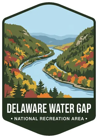
On the badge
The Delaware River curving through the deep notch between forested Mount Tammany and Mount Minsi, ridges in autumn color.
Planning a visit
Things to do
- Arts and Culture
- Auto and ATV
- Scenic Driving
- Biking
- Boating
- Camping
- Backcountry Camping
- Canoe or Kayak Camping
- Car or Front Country Camping
- Group Camping
- RV Camping
- Climbing
- Fishing
- Freshwater Fishing
Weather
Spring: Temperatures usually range from lows of 26 F to highs of 80 F with average rainfall of 5 inches. Summer: Temperatures usually range from lows of 55 F to highs of 85 F with average rainfall of 4 inches. Fall: Temperatures usually range from lows of 30 F to highs of 83F. Fall foliage is at its peak sometime in October as daily mountain temperatures vary frequently and influence the change. Winter: Temperatures usually range from lows of 15 F to highs of 49 F.
Getting there
Delaware Water Gap National Recreation Area is a long, narrow park that sits between two major interstates, I-80 at the south and I-84 at the north. US 209 is the main north/south road through the park on the Pennsylvania side and Old Mine Road is the main north/south road though the park on the New Jersey side.
Entrance fees
- Private Vehicle$10
Visitor details courtesy of the National Park Service. Official Delaware Water Gap site
 GatewayNY, NJ
 PinelandsNJ
 Statue of LibertyNY, NJ
 Ed JenkinsGA
 Flaming GorgeWY, UT
 Gauley RiverWV
 Glen CanyonUT, AZ
 Golden GateCA
 Grand IslandMI